Marine Vegetation Monitoring
About Marine Vegetation
Puget Sound supports a rich diversity of marine vegetation, including five species of seagrass and several hundred species of macroalgae, including over a dozen species of kelp. These plants and algae form the foundation of coastal ecosystems and provide essential habitat for many marine organisms, including several fish species listed as endangered or threatened under the Federal Endangered Species Act.
Eelgrass and kelp play a crucial role in supporting the health and resilience of nearshore environments by:
• Absorbing and storing large amounts of carbon, which fuels both local and distant food webs.
• Creating structurally complex environments that offer refuge and shelter to marine species.
• Supporting high levels of biodiversity and providing critical habitat for forage fish and juvenile salmonids.
Eelgrass and kelp are sensitive to stressors such as climate change, physical disturbance, and eutrophication, and are considered important indicators of habitat condition and ecosystem health. Both eelgrass and kelp are included in the Puget Sound Partnership’s list of Vital Signs for Puget Sound recovery.
More About Seagrass
Of the five species of seagrass in Puget Sound, Eelgrass (Zostera marina) is by far the most abundant, growing mostly in the intertidal and shallow subtidal habitats. It lives in muddy to sandy substrates and low to moderately high-energy environments. Eelgrass also helps prevent erosion and helps to maintain shoreline stability by anchoring seafloor sediment with its spreading roots and rhizomes.
Seagrasses are used as an indicator of estuary health throughout the world, because of their fast response to changes in water quality. Changes in the abundance or distribution of this resource are likely to reflect changes in environmental conditions. They are also likely to affect many other species that depend on seagrass habitat.
For more information on how you can help eelgrass check out the Anchor Out website.
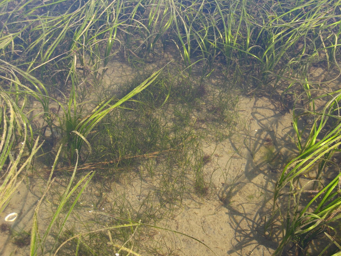
Presence of Zostera marina and Zostera japonica. Z. japonica is the smaller species in the middle of the image, and Z. marina is present in the surrounding area.
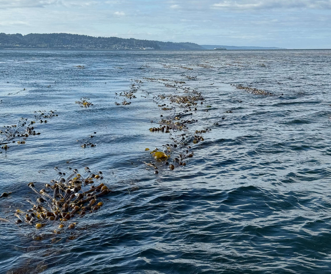
Bull kelp forming surface canopies near Hat Island.
More About Kelp
The term kelp refers to a group of large brown macroalgae in the order Laminariales. These algae are found throughout greater Puget Sound and are often the dominant vegetation in intertidal and subtidal habitats with solid substrate.
Bull kelp (Nereocystis luetkeana) is the largest species of brown algae native to our region. This fast-growing seaweed can grow as much as 60 feet in length in a single year and is an important part of the rocky intertidal ecosystem. It serves as both a primary producer in the food web of Puget Sound and as shelter and habitat for fish, invertebrates, marine mammals, and birds. In addition, the intricate structure of this living habitat buffers against current and wave energy to help protect the nearshore ecosystem.
In the Puget Sound, there have been noticeable declines in bull kelp abundance. While it is unclear what has caused these declines, potential factors include toxic pollutants from stormwater, erosion, high sedimentation deposition, and overpopulation of kelp predators.
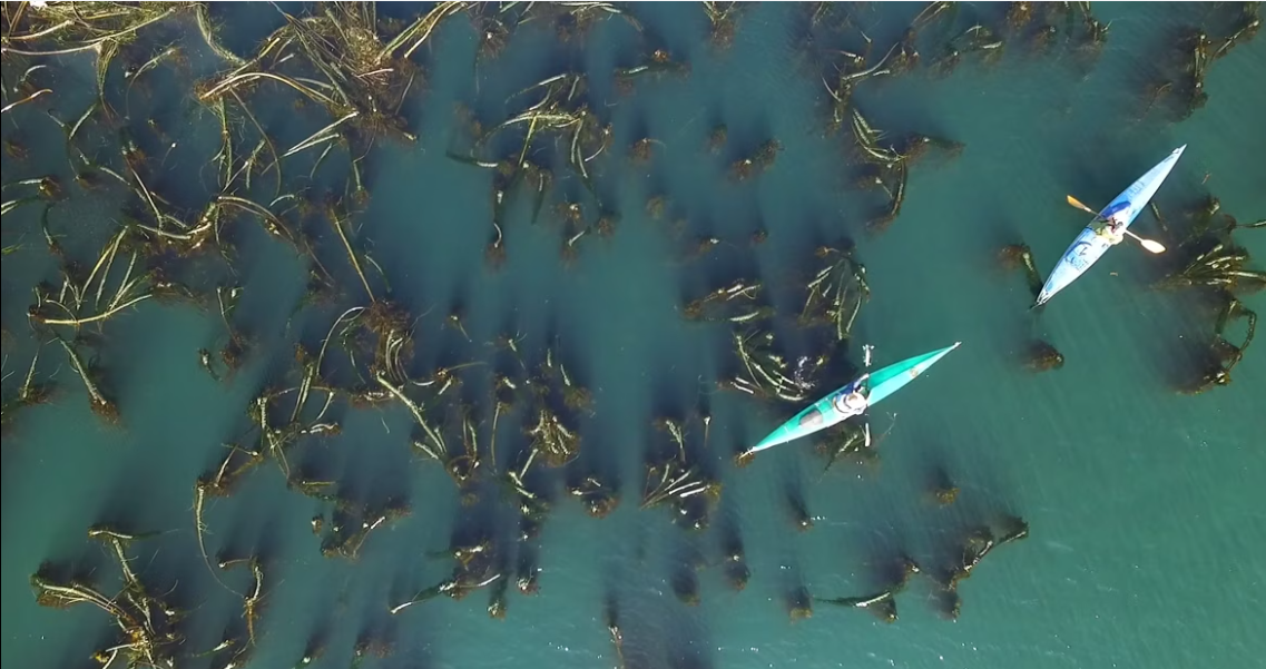
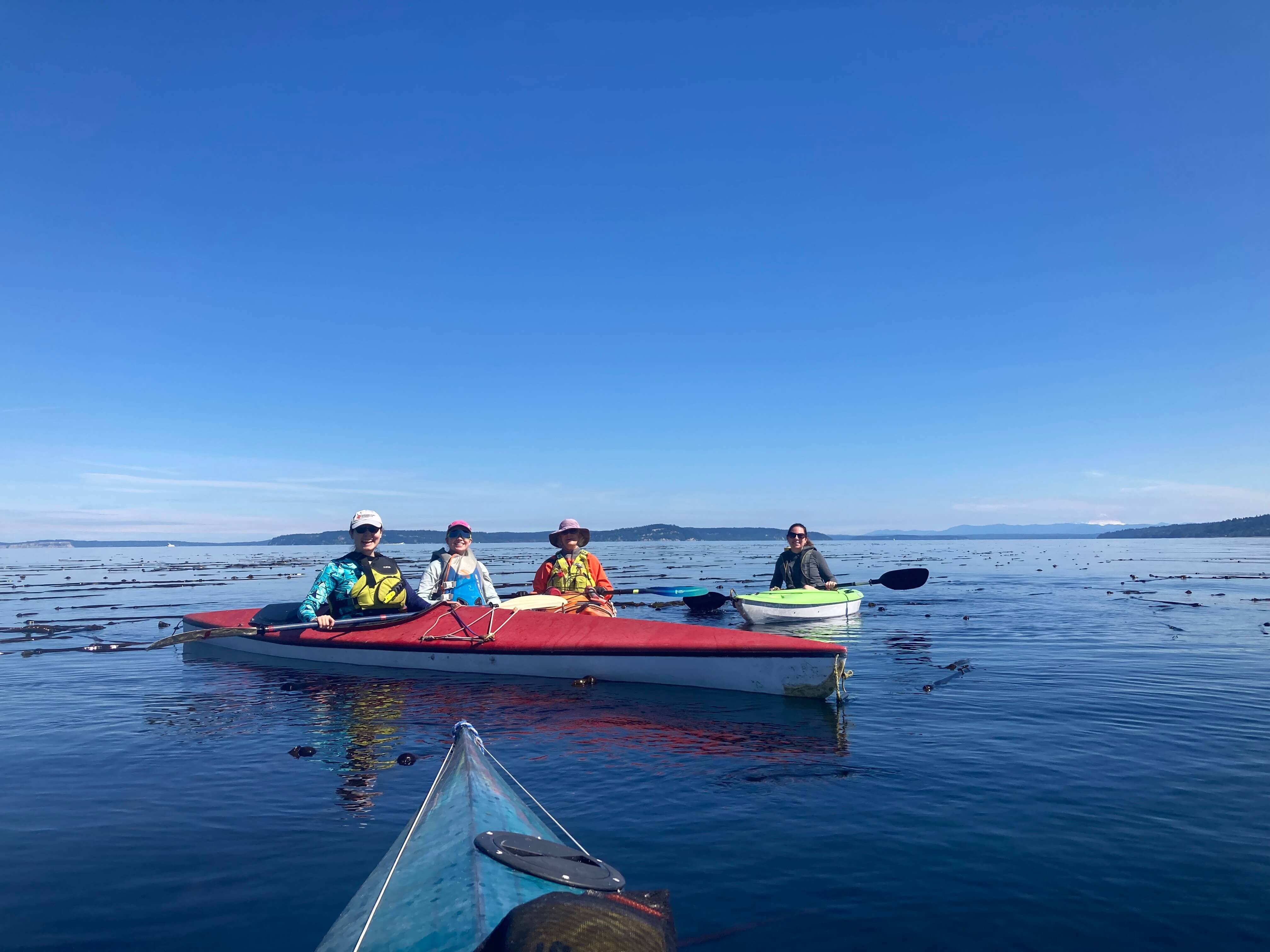
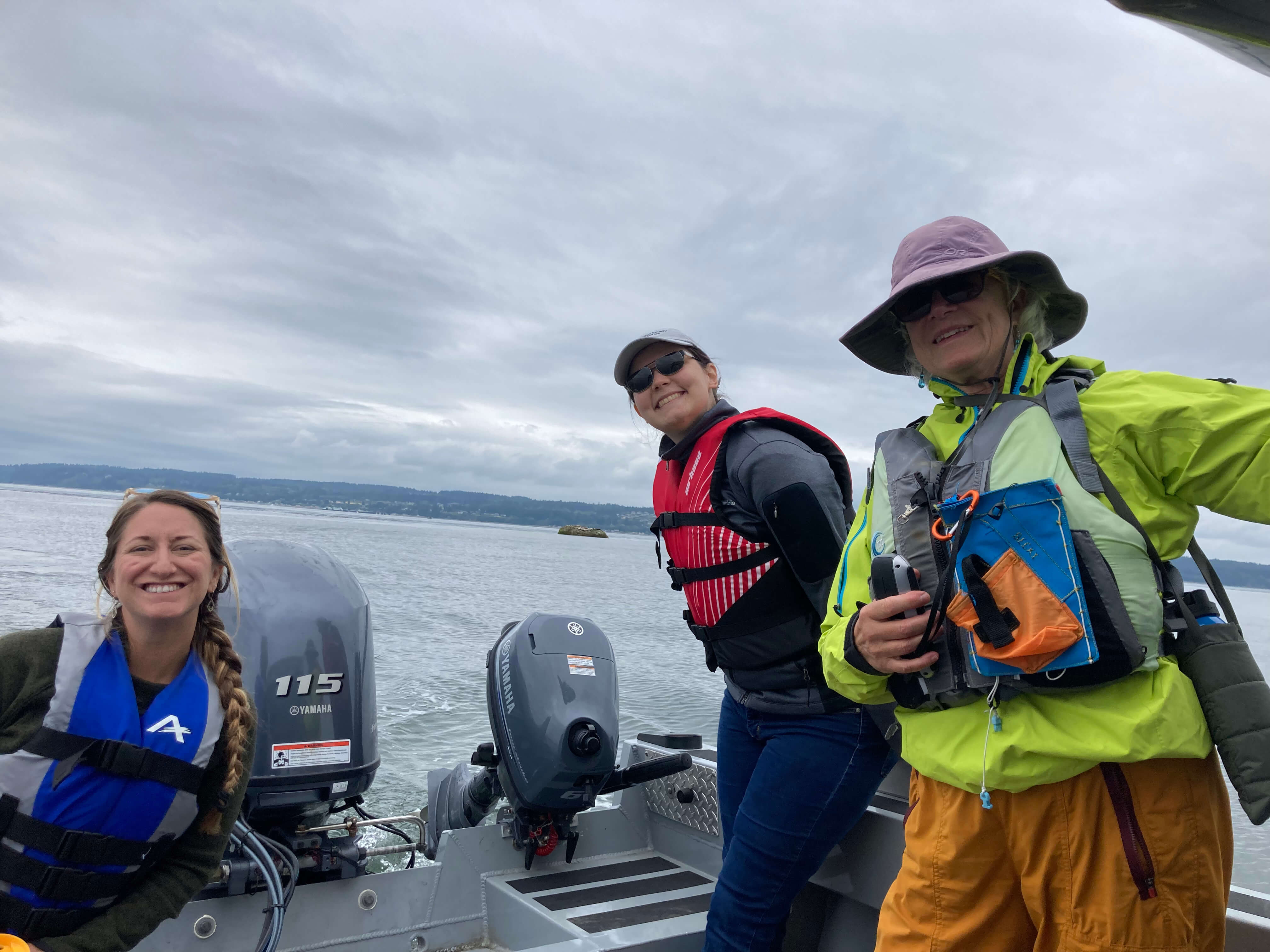
Kelp Kayak Monitoring by MRC Volunteers
In response to concerns over bull kelp decline and as part of our nearshore conservation goals, Snohomish County MRC seeks to understand how much kelp habitat is currently available in local waters. Towards that end, all seven regional MRCs throughout the Puget Sound are continuing to gather data as part of the Northwest Straits Commission’s Floating Kelp monitoring project which contributes to an expanding regional story map and interactive Arc GIS database that tracks changes in number of kelp beds and total acres measured. MRC members recently completed our monitoring via kayak in August 2025.
Northwest Straits Initiative Video about how MRCs survey kelp forests and what the data is used for.
In this video, the Snohomish County Marine Resources Committee shares how they monitor bull kelp beds by kayak, featuring footage from the Edmonds site in 2025.
In this video, the Snohomish County Marine Resources Committee demonstrates how they monitor the Hat Island kelp beds by boat, featuring footage from 2025.
The MRC kayak surveys cover the entire southern portion of the Snohomish County Nearshore from the Snohomish/King County border northward to the Snohomish River Delta. The MRC uses a standard protocol developed by The Northwest Straits Commission to simply and reliably monitor changes in existing kelp beds.
To see an example of what monitoring each season looks like, see the 2025 summary report.
Kelp monitoring data can also be viewed on the SoundIQ database, the Northwest Straits Commission’s web-based application to share data collected by MRCs and the Commission in an easily-accessible map format. MRC data on SoundIQ can be viewed in combination with complementary data from other sources.
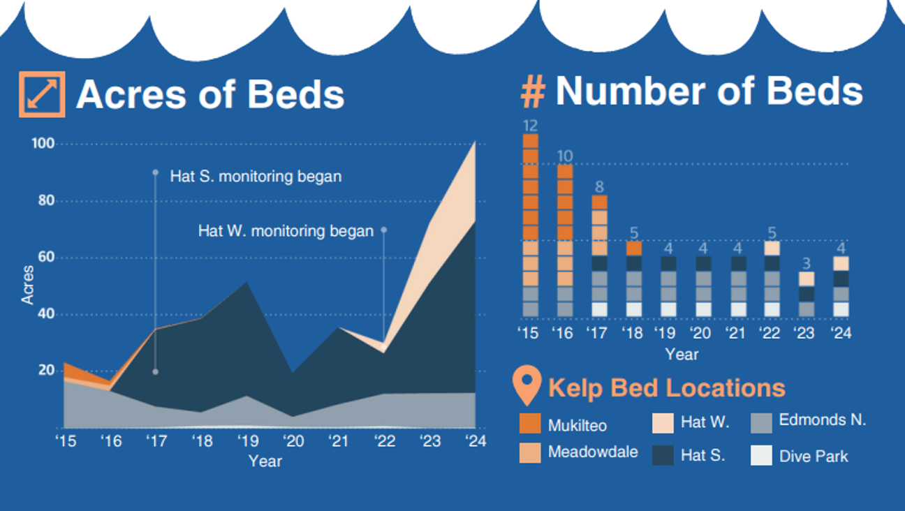
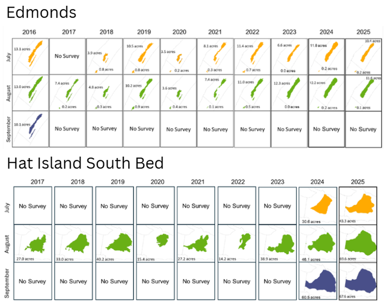
Figure shows the shape and size kelp beds from 2015 to 2024. The dotted line represents the standardized survey area. Color represents the month the kelp bed was surveyed (yellow = July; green = August; blue = September). Explore Meadowdale, Mukilteo, Hat Island West and enlarged versions of the kelp bed maps, on the Northwest Strait Initiative's story map by clicking on the image.
Community Outreach
In 2024, the MRC developed educational materials highlighting the Edmonds kelp beds and hosted its first Dive into Kelp event to help the Edmonds community learn more about their local kelp habitat. Building on that success, in 2025, the MRC expanded its outreach to the Mukilteo and Hat Island communities, creating site-specific materials and hosting a second Dive into Kelp and Eelgrass event to share the importance and current status of these kelp and eelgrass beds.
View our fact sheets:
View our information sheets for decision makers:
Monitoring Partnership with DNR
From 2019-2022, Snohomish County Marine Resources Committee worked with the Washington State Department of Natural Resources (DNR) to conduct a comprehensive study of marine vegetation (eelgrass, submerged kelp, and other macroalgae) along the shoreline of Snohomish County.
DNR monitors abundance and depth distribution of native seagrasses to determine status and trends in the greater Puget Sound area through the Submerged Vegetation Monitoring Program (SVMP). The SVMP monitors a selection of sites throughout the Puget Sound and extrapolates site-level data to create regional estimates of eelgrass area. Data are collected through submerged videography, based on DNR’s SVMP protocols. By partnering with DNR, Snohomish County was able to get a comprehensive survey of the entire Snohomish County shoreline. The monitoring results are used by DNR for the management of State-Owned Aquatic Lands, by the County and local jurisdictions to understand critical areas on their shoreline, and by the Puget Sound Partnership as one of 25 Vital Signs to track progress in the health and recovery of Puget Sound.
Key findings from the monitoring include the following:
- There were approximately 906 hectares of eelgrass in 1999-2007 and approximately 912 hectares of eelgrass in 2019-2022
- Comparing the 2019-2022 data with the 1999-2007 data it appears that there is little change in overall eelgrass area over time at a countywide scale, but variability at smaller scales was observed. Sites with increases in eelgrass were mostly located in the central and northern part of Snohomish County and are identified in purple on the map. While three sites showed a decrease trend and are identified in orange on the map.
- The depth distribution of marine vegetation in the study area was similar to other sites in the Central Basin of Puget Sound.
The Snohomish County Marine Resources Committee’s goal is to repeat this comprehensive monitoring every 7-10 years.
Additional details on the analysis can be found in the reports linked below.
Links to the Reports
For more information on the 2020 Marine Vegetation Monitoring of the Snohomish Delta, view the full report here: Eelgrass, kelp and other macroalgae near the Snohomish delta - Final report to Snohomish County
For more information on the 2021 Marine Vegetation Monitoring of South Snohomish County, view the full report here: Eelgrass, kelp, and other macroalgae in South Snohomish County - Final report to Snohomish County
For more information on the 2022 Marine Vegetation Monitoring of East Port Susan and Gedney (Hat) Island, view the full report here: Eelgrass, kelp, and other macroalgae in South Snohomish County - Final report to Snohomish County
Eelgrass Trend Monitoring
The purpose of this web application is to present the extents of eelgrass surface area from recent surveys (2019-2022) along the shoreline of Snohomish County, and to compare recent findings with previous studies. Sixteen out of the 62 sites sampled have been visited more than once by DNR SVMP. At 15 of these sites, DNR was able to assess change in eelgrass area over time through linear regression, or by comparing eelgrass cover along sets of transects that were resampled over time. Recent findings were also compared to a historical baseline of eelgrass along the shoreline of Snohomish County, compiled from several studies conducted between 1999 and 2007 (Bailey et al. 2007). These studies used different methodologies, including aerial imagery, side scan sonar, and a deep edge meander with towed underwater videography. Because of the differences in methodology, we can only assess large scale patterns in eelgrass area and depth distributions at most sites.